UN
27 Langdale Rise
£ 425,000
Description
We don't have a Description for this property.
- Bedrooms
- 4
- Bathrooms
- 0
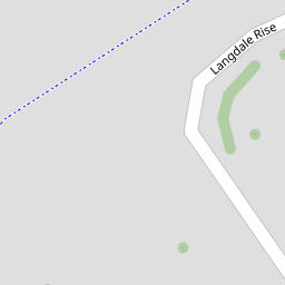

Leaflet © OpenStreetMap contributors
The heatmap indicates the level of crime in the area. The color of the heatmap indicates the crime severity and recency.
Metrics Year-on-Year
- Average area value
- 402,872.00 £Increased by 4.18 %
- Average area rental value
- 1,452.00 £/moIncreased by 11.95 %
- Est rental Yield
- 4.32 %Increased by 7.46 %
- Crime Rate
- 0.00 %
from 386,695.00 £
from 1,297.00 £/mo
from 4.02 %
from 0.00 %
Nearby Schools
| Name | Type | Ofsted | Distance |
|---|---|---|---|
| St Simon Stock Catholic School | Academy Converter | Good | 0.53 KM |
| St Francis' Catholic Primary School, Maidstone | Voluntary Aided School | Good | 0.56 KM |
| St Augustine Academy | Academy Sponsor Led | Good | 0.77 KM |
| Palace Wood Primary School | Community School | Good | 0.79 KM |
| Oakwood Park Grammar School | Academy Converter | Good | 0.84 KM |
Images
Nearby Streets
| Name | Average Price | Average Sqft | Distance |
|---|---|---|---|
| Speldhurst Court | £ 0 | 0 | 0.00 KM |
| Beech Drive | £ 600,000 | 0 | 0.00 KM |
| Palmar Road | £ 550,000 | 0 | 0.00 KM |
| Newbury Avenue | £ 345,000 | 0 | 0.00 KM |
| The Russets | £ 500,000 | 0 | 0.00 KM |
Nearby Transport
| Name | NLC | TLC | Distance |
|---|---|---|---|
| Maidstone Barracks | 5237 | MDB | 1.68 KM |
| Maidstone West | 5222 | MDW | 2.02 KM |
| Barming | 5133 | BMG | 2.35 KM |
| Maidstone East | 5115 | MDE | 2.49 KM |
| East Farleigh | 5234 | EFL | 2.89 KM |
Nearby Listings
| Address | Price | Type | Score | Distance |
|---|---|---|---|---|
| Langdale Rise, Maidstone ME16 | £ 550,000 | BUY | 7 / 10 | 0.00 KM |
| Langdale Rise, Allington | £ 535,000 | BUY | Unknown | 0.09 KM |
| Sterling Avenue, Allington, Maidstone ME16 | £ 400,000 | BUY | 6 / 10 | 0.10 KM |
| Roseleigh Avenue, Maidstone, Kent | £ 450,000 | BUY | 7 / 10 | 0.14 KM |
| Shaftesbury Drive, Maidstone, Kent, ME16 | £ 400,000 | BUY | 7 / 10 | 0.14 KM |
Nearby Properties
| Address | Price | Distance |
|---|---|---|
| 64 Langdale Rise | £ 600,000 | 0.00 KM |
| 54 Langdale Rise | £ 440,000 | 0.00 KM |
| 50 Langdale Rise | £ 370,000 | 0.00 KM |
| 71 Langdale Rise | £ 320,000 | 0.00 KM |
| 82 Langdale Rise | £ 296,000 | 0.00 KM |